Click on the images to open videos on Science...
| | INACHUS project |
|---|

| ONERA 3D LAB | 2019 | 3'16" The role of 3D mapping of collapsed areas in the INACHUS project is to provide the USaR personnel with accurate and timely 3D models to support situation assessment, localization of survival spaces and rescue paths and planning of actions. To be able to do this as efficiently as possible, a strategy is needed for how and when the respective 3D mapping systems should be used and how their respective strengths should be exploited, so as to offer maximal support in the search and rescue phase. The 4-main objectives are detailed hereafter: - Wide-area disaster scene assessment based on nested integration of space-borne information and Finite Element Method (FEM) results, and population distribution mapping, for 3D modelling and USaR prioritization,
- Provide high resolution and high quality 3D Digital Surface Models (DSM) coming from laser cameras and photogrammetry data on the most affected areas,
- Perform an exploitation of this 3D data in relation with the library of collapsed building models using a semantic analysis or matching method,
- Assess the structural damage to deliver maps of survival space and rescue path.
|
| | 3D LiDAR embedded on a gyrocopter |
|---|
 | ONERA 3D LAB | 2018 | 4'07" 3D LiDAR has been one of the most eagerly anticipated technologies of the last 10 years. ONERA, The French Aerospace Lab develops and uses various techniques to enhance the vision of mobile vehicles, drones and aircrafts. LiDAR is a land surveying technique using high precision laser scanners as well as GPS and INS providing a high level of accuracy from the air. Learn more about this technology opening this video... |
| | Cité de Carcassonne in 3D, France |
|---|
 | ONERA | 2016 | 2'06" | French version ONERA, The French Aerospace Lab celebrated its 70 years of existence. The famous medieval Cité de Carcassonne is retrieved in 3 dimensions thanks to laser imaging techniques. |
| | Saint-Sernin church in 3D |
|---|
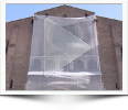 | ONERA | 2015 | 9'28" | French version Scientific experts from ONERA carry out the three-dimensional modeling of the Saint-Sernin basilica (Toulouse, France), as well as the auscultation of basements using infra-red cameras. Pierre Pisani, director of the Archeology Department of Toulouse-Métropole, oversees operations... |
| | Podcast ONERA on active imagery |
|---|
 | ONERA | 2015 | 16'35" | French version Laser radar (LADAR or LiDAR) technology has enjoyed significant advances over the past decade. Novel focal plane areas, compact laser illuminators and advanced signal processing have enabled the construction of low power 2D and 3D laser imagery systems. The applications of such systems range from surveillance, targeting and weapons guidance to target identification. One can enhance the performance of a camera with short-pulse laser illumination to freeze the motion of moving subjects... 3D laser imagery is explained in this interview. Learn more about 3D active imagery techniques... |
| | 3D Laser Imagery |
|---|
 | ONERA | 2011 | 6'39" 3D laser imagery is not magical. Behind the mirrors (found in the laser probe) there is a lot of know-how and experience that makes the laser imagery experience seem so easy. A 3D laser imaging system is a non-contact, non-destructive technology that digitally captures the shape of physical objects using a laser beam. Day and night vision is possible thanks to the laser illumination. Moreover, it allows seeing in high resolution through bad weather conditions (rain, fog, haze, snow). This technique creates “3D point clouds” of data from the surface of an object. Laser imagery is the fastest, most accurate, and automated way to acquire 3D digital data for reverse engineering even through adverse meteorological conditions (low visibility). |
| | From laser sources to applications |
|---|
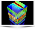 | ONERA | 2010 | 8'33" Light scattering due to angular reflectance is one of the most commonly measured and modeled optical phenomena, relevant in fields ranging from materials science and medical imaging to 3D computer graphics and animation. Analytical methods that make use of the phenomenon include remote sensing, target detection, and radiance signature evaluation for passive or active sensors. Modeling reflectance phenomena requires the formulation of a hyperspectral polarized BRDF (bidirectional reflectance distribution function) and an understanding of its importance in surface optical phenomena. The BRDF quantifies how light is angularly and spectrally reflected by a material illuminated from different directions. It is a unique optical signature of a material and one of the crucial functions needed to model radiative transfer, laser imaging, medical imaging, and remote sensors. Recent innovations in Supercontinuum or white laser sources provide a very useful tool to probe materials physical and optical properties. ONERA, The French Aerospace Lab, has developed a fast, in-line and comprehensive optical characterization method. From the combination of hyperspectral, polarized and angular measurements, physical properties of dense materials are to be retrieved. Discover MELOPEE LAB in this video... |
| | 1960: the first LASER |
|---|
 | CNRS | 2010 | 9'21" Theodore Maiman made the first laser (light amplification by stimulated emission of radiation) operate on 16 May 1960 at the Hughes Research Laboratory in California, by shining a high-power flash lamp on a ruby rod with silver-coated surfaces. He promptly submitted a short report of the work to the journal Physical Review Letters, but the editors turned it down. A laser is a device that emits light through a process of optical amplification based on the stimulated emission of electromagnetic radiation. Discover more about this technology opening this video... |
| | Gravitational waves |
|---|
 | CNRS | 2010 | 3'25" Gravitational waves are the disturbance in the curvature of spacetime that are generated by accelerated masses and propagate as waves outward from their source at the speed of light. They were first proposed by Henri Poincaré in 1905 and subsequently predicted in 1916 by Albert Einstein on the basis of his general theory of relativity. |
| | Rangueil Campus in Toulouse, France |
|---|
 | INA | 1965 | durée 3'59" Discover the illustrious history of the Rangueil Campus thanks to this digitized archival video. The beginning of an ambitious, constantly evolving project: the University of Science of Toulouse (Paul Sabatier), the World leader in aerospace engineering higher education (ISAE-SUPAERO) and the leader in aerospace research activities (ONERA, The French Aerospace Lab) located on the same scientific area in Toulouse, France. |
| | The Mass by Etienne Klein |
|---|
 | Au tableau (French version) | 2010 | 6'35" Mass is both a property of a physical body and a measure of its resistance to acceleration when a net force is applied. It also determines the strength of its mutual gravitational attraction to other bodies. Discover this famous short lecture from Etienne Klein (French version). |
| | One Giant Leap For Mankind |
|---|
 | NASA | 20 July 1969 | 1'24" July 1969. It's a little over eight years since the flights of Gagarin and Shepard, followed quickly by President Kennedy's challenge to put a man on the moon before the decade is out. At 10:56 p.m. EDT Armstrong is ready to plant the first human foot on another world. With more than half a billion people watching on television, he climbs down the ladder and proclaims: "That's one small step for a man, one giant leap for mankind." |


